

The Hill Country, Texas
October 21-26th, 1998
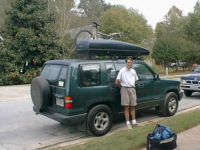
| Ahhh... on the road, finally. After much work on the
vehicle, including a major fiasco trying to figure out how to remove the rear seats (very
strange looking bolt required an impossible to find socket), I was finally ready to go on
Wednesday, October 21st. I headed out around noon and drove west on I-20 towards
Texas. My plan was to take I-20 to Monroe Louisiana and spend the night in the .
My plan was to spend the night in the Russell Sage Wildlife Management Area near
Monroe, LA. During the drive, I decided, my daylight hours would be better spent
finding a campsite. Fumbling around the dark trying to find a place to park for the
night didn't sound like a good idea. My intuition was correct. Using Microsoft
Streets 98 and a GPS, I was able to navigate through the roads of the Bienville National
Forest in Mississippi and find a place. (If Microsoft actually labeled these FS
roads, things probably would have been easier, but at least they were there!) The Bienville National Forest was a pretty nasty place. There seemed to be some nice areas, however, as the picture shows, logging has taken it's toll on the forest there. It was completely flat. The only hills I saw were from road pushouts and forestry work. It is interesting to note that the government is wasting your hard earned tax dollars on de-foresting our national resources and heritage... the timber sales do not produce a profit, they produce a deficit! After driving around for a while, I found a nice 4wd road. I then headed into town to pick up some dinner fixin's and cooked up a nice stir fry dinner followed by an attempt to make some brownies in my Outback Oven. I figured these should keep me awake for the long drive on Thursday. The sound of crickets filled the air. I heard some racoons fumbling around the forest, checking out their new visitor. I actually got a great nights sleep for the first time in my vehicle, and after some oatmeal, was ready to hit the Louisiana/Texas roads. Long drive. The only thing of note during the drive was the Traffic Street exit in Shreveport LA. I don't know about you, but that doesn't sound like a good place to exit. Sounds like a good name for I-285 in Atlanta during rush hour. 285sucks.com :-) I finally arrived in San Antonio after driving into a blinding sunset for a couple of hours. I recommend avoiding this period of time if you are driving west in the flatlands of Texas. The sunset was beautiful, but very painful on the eyes! At least it kept me alert! I arrived at Cliff's house at 9pm. The next day, we headed out for 2 days/2 nights of backpacking the Texas Hill Country. After some phone calls, we decided to go to Hill Country State Natural Area. A slight communication error ensued. I had just called Hill Country State Natural area to find they had some 30 miles of trails which sounded great for backpacking. Cliff thought I had called Colorado Bend State Park. So little did I know, Cliff, the navigator AND driver for this trip, drove us to Colorado Bend. Once we got there, we found only about 3-4 miles of backpacking at Colorado Bend, hardly enough to satisfy our backpacking appetites. (Ah, communication... Sometimes, I wonder if animals has mastered this more than us humans have!) No biggie this time. I enjoyed the brief view of the scenery at Colorado Bend and off we went to Hill Country State Natural Area. They have this thing called the Edwards uplift here in Texas (if I recall correctly). The Edwards uplift is an area that rises above the surrounding countryside. This forms what Texans call the Hill Country. (I originally thought they were simply describing the landscape, but Texas has actually labeled the region "The Hill Country".) Most of the land out there was and is used for ranching... raising cattle mostly. You can tell this area was purchased from ranchers by the state. We stayed under an old livestock feeding area the first night and under the awning of a farmer's shack the second night. The area was really beautiful and the pictures should give you an idea of what the landscape is like. Most of the hiking was flat, followed by steep eroded climbs up some of the mountains and valleys. I would call the area "semi arid" as there seemed to be no shortage of water... then again San Antonio just had some serious floods. The high water table afforded us some nice views of flowing streams and ponds (manmade). But the majority of the earth seemed to be dry... very little rich topsoil. There were a few areas low lying areas that surprised us though. It was really neat to see the different habitats out there. You certainly can't find stuff like this in the Southeast. Yuccas and Prickly Pear abound and some of the wildflowers were beautiful to see as well. We actually found some Rabbit Tobacco (Pearly Everlasting) growing under the cedars and had a nice smoke out of Cliff's pipe our second night out. Very smooth. During our stay, we actually saw the majority of the park. We missed the southern part... Ah well, like I say, a good reason to come back... I have to wonder what this area looked like before we grazed cattle on it... I would have to guess this area was home to tipi buiding Indians before us and the cows kicked them out. After a good nights sleep at Cliff's mother's house, I'm on the road again. Thanks a ton to Cliff and his mother for making me feel welcome in their home. I had a wonderful time in San Antonio and the Hill Country. |
|
|


Technology Update
I'm not sure when I'll be able to update these pages again. It may be up to 3 weeks. I've discovered on this trip that Cellular modem technology is pretty lousy and I would use up all my minutes trying to update my web pages at 4800 baud. About all I can do is check e-mail (and large e-mails (ie with attachments) are out of the question!). Plus, I doubt I'll be able to even get a cell in Southwest Texas. Sooo... any help would be appreciated. I will be in the following areas until the week of Thanksgiving (when I'll be home). I would just need a land line for a few minutes so I can run NetLoad to update my web pages.
Coming Next...
In Texas... Amistad National Recreation Area, Big Bend, Guadelupe Mountains, and in New Mexico... Carlsbad Caverns.
More Information on Hill Country State Natural Area
Hill Country State Natural area has some 36 miles of trails. Nearly all of these trails are open to Mountain Bikers and Horses as well as hikers. There is definitely enough hiking for a long weekend backpack trip and the scenery is nice. The only facilities offered include pit/chemical toilets, a pay phone, tent sites, and equestrian sites. Nothing else, and I mean nothing! All activities in the park require some type of fee, including the backcountry camping. The park is about 20-30 minutes from Bandera, Texas. For more information:
Hill Country State Natural Area
Route 1, Box 601
Bandera, TX 78003
(830)796-4413
Reservations: (512)389-8900
My E-Mail address is: andrew(at)koransky.com
Copyright (C) 1996-2020 Andrew Koransky